
The Best Coastal Destinations to Discover Around Buton Island
A research-led guide to Buton and Baubau coasts, island routes, heritage context, local access, and responsible shoreline travel.
Compare Buton coastal experiences by landscape, history, access, community use, weather, and the kind of day each route can realistically support.
The coast around Buton Island should not be reduced to a single beach ranking. Buton and Baubau bring together limestone shorelines, island water, historic settlement, working boat routes, beaches, caves, and communities whose daily lives are connected to the sea. A traveler looking for a quiet coastal walk needs different information from a family seeking a safe swimming stop, a photographer looking for rock and light, or a heritage traveler who wants to understand how the old Buton Sultanate relates to the city and its surrounding waters.
This guide uses the project destination data together with heritage, tourism, and weather context to explain how to choose a coastal route responsibly. It does not publish an invented list of opening hours, prices, water depths, or fixed boat times. Those details change and must be confirmed with a local operator close to departure. The central question is not which shore is permanently the best, but which coastal experience matches the group, the sea, the access route, and the people who use the place.
How to Read a Buton Coastal Destination
A coastal destination is more than sand beside blue water. It may be a public beach, a village shoreline, a boat landing, a limestone outcrop, a reef edge, a historic waterfront, or a place where people work. Each setting creates different expectations about walking, swimming, photography, noise, clothing, waste, and access. A useful Buton travel guide should name the kind of coast the traveler is approaching before it describes the view.
The phrase best coastal destination is therefore relative to purpose. A family may value shade, a manageable path, a clear meeting point, and an alternative for anyone who does not want to swim. A photographer may prefer a coast with changing rock forms and enough time for light. A heritage traveler may prefer a Baubau route that connects the sea with the history of the Buton Sultanate. A marine traveler may select a shore because it is the starting point for a boat route, not because it is the most comfortable place to sit.
Buton coastal planning also needs a distinction between an editorial fact and a current operational fact. The island and city context can be explained through official heritage and tourism information. Current water conditions, facilities, local fees, access restrictions, boat arrangements, and the availability of a guide must be checked for the selected date. A photograph cannot prove that a shore is suitable for swimming or that a path is open.
This approach gives readers a stronger basis for comparison. Instead of asking for the most beautiful beach in the abstract, ask which shore supports the group activity, how it is reached, who uses it, and what happens when wind, tide, rain, or local work changes the plan. That is the beginning of accurate coastal travel around Buton.
Baubau as a Historic Coastal Gateway
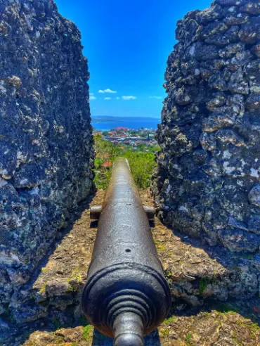
Baubau is important in a Buton coastal itinerary because the city is not separate from the island story. It is a gateway through which travelers can understand the relationship between settlement, sea routes, and the history of the Buton Sultanate. The fortified Keraton Buton area provides a heritage dimension that can be planned alongside, rather than disconnected from, coastal observation. The route may move from an elevated historic setting toward water, boats, and the city shoreline, allowing travelers to see how geography and political history meet.
A heritage-coast route should be paced differently from a beach checklist. Travelers need time to listen to interpretation, ask where a historic structure or view fits in local history, and move without treating the site as a backdrop for a rushed photograph. The exact areas open to visitors, photography expectations, guide arrangements, and current fees require confirmation. A responsible article can explain the historical importance without pretending that every part of a heritage area has identical access.
Baubau can also be a useful place to organize the rest of a Buton journey. Travelers may confirm transport, food, accommodation, local guides, and the order of coastal or island activities before moving farther from the urban gateway. This is especially important for groups carrying equipment or traveling with children, older people, or guests who need predictable rest. A practical base is valuable because it reduces avoidable uncertainty before the group reaches a more remote shoreline.
The city should not be presented only as a transit point. Its coastal meaning becomes clearer when travelers notice the movement of people, boats, goods, and stories between the urban area and the wider island. Ask local guides which viewpoints, shorelines, and heritage spaces are appropriate for the group, then allow the route to be shaped by current conditions and local knowledge.
Limestone Coast and Island Landscape
Buton is associated with limestone landscapes, and that geological setting affects how travelers experience its coast. Limestone can create cliffs, rocky edges, caves, pale surfaces, coves, and uneven ground. These features may be visually striking, but they also change the practical questions a visitor must ask. A rocky shore is not automatically a swimming beach. A cave entrance is not automatically safe after rain. A dramatic coastal edge may require distance and a guide rather than closer access.
Travelers should ask what type of shoreline is included in the proposed route and how the group reaches it. Does the path involve stairs, loose rock, wet ground, or a boat landing? Is the shore used by residents or boats? Is there a place to wait in shade? Are food, drinking water, toilets, and waste arrangements confirmed? These questions are not excessive. They help the operator match the destination with the group and avoid presenting a natural landscape as if it were a serviced resort.
The limestone context also matters for conservation. Rock surfaces, coastal vegetation, cave formations, and reef edges can be damaged by touching, climbing, collecting, or careless movement. Visitors should stay on an agreed route, avoid removing stones or shells, and follow instructions about where to stand. If a guide asks the group not to enter a particular section, that limit may protect fragile geology, a community use area, or a safety concern that is not visible in a photograph.
A good coastal day makes room for observation. Notice the relationship between rock, water, settlement, boats, and light instead of measuring the route only by how many stops are completed. Buton becomes more distinctive when its coastal landscapes are understood as part of a living island rather than as interchangeable scenery.
Choosing a Beach for the Group
The right beach depends on who is traveling. Families should ask about entry, shade, walking surfaces, supervision, water, food, and a safe alternative for children or adults who do not want to swim. Strong swimmers may still need information about current, tide, boat traffic, reef, and rock. A photographer may want a quiet period with changing light, while an active group may prefer a coast that connects to a confirmed boat or snorkeling activity.
Never infer swimming safety from clear water or a calm image. Conditions can change with tide, wind, rainfall, waves, currents, and boat movement. Ask the local operator or guide to assess the exact shoreline on the day. If the water is unsuitable, a responsible alternative may be coastal observation, photography, a heritage route, or a different shore. A changed activity is better than pressuring a guide to treat a photograph as a safety assessment.
A beach visit should also account for time before and after the water. Travelers need a place to change or protect wet clothing, a plan for personal medication and electronics, and enough time to return without rushing the next connection. If the beach is reached by boat, ask where luggage remains and how the group boards again. If it is reached by road, ask about the final walking surface and whether rain changes the approach.
The best beach for a particular group is the one that leaves enough energy for everyone to participate. A short, well-understood stop may be more enjoyable than a distant shore reached after a tiring transfer. Confirm the route with the operator and describe the result accurately afterward rather than generalizing one good day into a permanent promise.
Island and Boat-Based Coastal Experiences
Some of Buton’s strongest coastal experiences may be understood from the water or through a short island connection. Boat travel changes the scale of the landscape: the shoreline becomes a sequence of coves, rock faces, beaches, landing points, and working areas. It can also reveal why a route needs more planning than a road itinerary. Loading, weather, fuel, boat capacity, sea state, and the return connection all affect the day.
Before booking a boat-based coastal route, ask for the departure point, expected sequence, luggage arrangement, life-jacket practice, shade, drinking water, communication method, and weather alternative. Do not rely on a public article to state an exact duration unless it has been confirmed for the actual boat and route. A journey that looks short on a map can include waiting, loading, landing, and a return movement that takes much longer than the crossing itself.
The crew’s decision should control whether the route departs. Wind, waves, rain, visibility, and tide can affect both comfort and safety. Travelers should not pressure a captain because a beach or island was printed in a package description. A different coastal view, a land-based heritage route, or a delayed activity may protect the purpose of the day without forcing an unsafe movement.
Boat travel also requires respect for the coast as a working environment. Keep bags out of crew paths, follow instructions near a landing, do not photograph people or boats without permission, and do not assume that every shore is open for visitors. The journey is stronger when travelers understand that the boat connects communities and work as well as tourism.
Coastal Heritage and the Buton Sultanate
The coastal story of Buton cannot be separated from its historical identity. The Buton Sultanate and the heritage landscape around Baubau give travelers a way to understand the island beyond beaches and marine photographs. A historic settlement, fortification, viewpoint, or waterfront should be approached through evidence and local interpretation. It is not enough to attach a dramatic legend to a wall or describe a historic area as old without explaining which claim is documented and which belongs to oral history or interpretation.
Travelers should ask who provides the explanation and how the site is managed. An official heritage description, an academic study, a local guide’s account, and a family story can all have value, but they should not be presented as the same kind of evidence. A careful article names the source of a claim and avoids pretending that one short visit resolves a complex history. This is especially important when the destination is used for public marketing.
Photography requires the same care as interpretation. Ask before photographing residents, religious or cultural activities, private homes, work areas, and identifiable individuals. A historic wall may be public while the people standing nearby are not part of a visitor’s content by default. Explain the intended use when an image will be used commercially, and accept a refusal without negotiating it away.
A coastal heritage day can combine a guided historic visit with a shoreline observation or city route, but it should not be compressed into a sequence of photo stops. Leave time for questions, walking, shade, meals, and the possibility that a guide will adjust the order. The history of Buton becomes more intelligible when the sea, settlement, and inherited places are read together.
Community Shores Are Living Places
Many attractive coastlines are also places where people live, work, fish, travel, repair boats, gather food, or manage community activities. A visitor should not interpret an empty-looking frame as proof that a shore is unoccupied or freely available. Ask before entering a village path, stepping near a boat, photographing a household, or using a place where residents are working. Local guidance is part of the destination information, not an obstacle to it.
If a community visit is included, confirm who hosts it, what the group will do, whether a contribution is expected, how large the group can be, and what photography or recording rules apply. Do not promise a performance or a conversation unless it has been coordinated. Residents should be able to decide whether and how they welcome visitors. A respectful encounter may be quiet, ordinary, and different from the dramatic story a marketing page imagines.
Use local services transparently. Ask whether a guide, boat owner, food provider, or community coordinator is part of the arrangement and what the payment covers. Avoid claiming that tourism automatically benefits everyone in a village. Accurate language recognizes the people who provide a service and leaves room for the community to explain how visitors should participate.
This approach improves the coastal experience for travelers as well. A guide can explain why a landing point is important, where the group may wait, which area is private, and how to move without interrupting work. The result is more informative than treating local life as decoration around a beach.
Weather, Tide, and Sea Conditions
A coastal itinerary must be built around change. Wind affects boat comfort and departure decisions. Waves affect landings and swimming. Tide changes the shape and access of a shore. Rain affects roads, rock surfaces, visibility, and the comfort of waiting outside. A route can be possible in one set of conditions and unsuitable in another, even when the destination itself has not changed.
Travelers should check official weather and marine information when available, then ask a local operator for a practical assessment of the exact route. Forecast data cannot describe every landing, road, rock, or community schedule. Local knowledge also cannot guarantee a future condition, so the best plan combines both sources and keeps a realistic alternative.
The alternative should preserve the purpose of the day. If a boat route is delayed, a heritage walk, city route, coastal observation, or confirmed inland destination may work. If swimming is unsuitable, the group can observe the coast without entering the water. An alternative is useful when it is agreed before departure and when it does not create a new unsupported promise.
Pack for this uncertainty without inventing facilities. Bring sun and rain protection, practical footwear, personal medication, drinking water as advised, spare clothing, and secure protection for documents or cameras. Ask what the operator supplies and where wet or valuable items are stored. Preparation gives the group flexibility, but it does not replace a local decision about safety.
Conservation at the Shore and Reef Edge
Coastal travel leaves an impact even when a visitor does not enter the water. Footsteps can damage vegetation or unstable surfaces, litter can reach the sea, and careless boat handling can affect shallow reef or shoreline habitat. Keep waste contained, use the disposal arrangement provided, and do not remove shells, stones, coral, plants, or historical fragments as souvenirs.
At a reef edge, maintain buoyancy and keep fins, cameras, gauges, and bags away from coral. Never stand on the reef to take a photograph or use coral as a handhold. Do not feed wildlife, chase animals, or encourage a guide to manipulate an encounter. The best marine photograph is one made without changing the behavior or condition of the subject.
Heritage conservation requires a similar restraint. Do not scratch, climb, lean against, wet, or mark historic surfaces. Follow restrictions about flash, distance, group size, and access. If a place is closed or a guide asks visitors to remain outside a section, accept the decision. A restricted view is preferable to damage that cannot be repaired.
Conservation also includes pacing. Fewer stops can mean less hurried landing, better briefings, smaller pressure on one shore, and more time to listen to local guidance. A coastal itinerary should be measured by the quality of attention and the care taken, not only by the number of beaches or viewpoints recorded.
Packing and Physical Preparation
The appropriate packing list depends on the exact Buton route. A beach and city day may require practical footwear, sun protection, drinking water, and a change of clothes. A boat route adds rain protection, a secure dry bag, and careful storage for medication and electronics. A heritage or limestone route may require shoes with reliable grip and the ability to walk on uneven surfaces. Ask the operator to describe the approach plainly before departure.
Tell the operator about mobility needs, heat sensitivity, allergies, medication, children, older travelers, and anyone who is not comfortable in open water. This information can change the destination choice, the length of a stop, the need for shade or rest, and the plan for returning to the vehicle or boat. A route should be designed around the actual group rather than a generic image of an adventurous traveler.
Keep essential items accessible instead of burying them in a large bag. Documents, medication, dry clothing, water, and rain protection may be needed during a delay or a changed landing. Protect equipment from spray without blocking crew movement. Ask whether the group carries luggage during a coastal walk or leaves it at an agreed point.
Physical preparation is also about pace. A group that rushes from a boat to a rock, then to a heritage site and a beach, may be too tired to listen or move carefully. Build periods for food, hydration, shade, and recovery. The coast is easier to appreciate when the body is not being asked to ignore every practical limit.
How to Build a Buton Coastal Itinerary
Begin with one main purpose: beach rest, marine observation, heritage, photography, community learning, or a combination that the group can realistically sustain. Then choose a base and ask the operator which coastal destinations are practical from that base on the selected date. Baubau may support a city and heritage beginning, while a farther coastal or island route may require more time, a boat, or an overnight arrangement.
Give each stop a role. A heritage route can provide context before a coastal viewpoint. A beach can provide recovery after a longer walk. A boat journey can connect shorelines but should not be treated as invisible transport. A community visit needs time for hosting and consent. When every stop has a reason, the itinerary is easier to shorten when weather or access changes.
Use a priority system: one experience that must happen if conditions allow, one suitable alternative, and optional stops that are added only when time and group energy permit. This prevents a long destination list from becoming a promise to force every place into one day. It also gives the operator a clear way to protect the route when a landing, beach, or heritage space is not suitable.
Before payment, request the itinerary in writing and check the exact inclusions. Ask about transport, accommodation, meals, guide support, boat, entrance or community arrangements, equipment, weather changes, and cancellation or substitution terms. The public article can help the traveler ask those questions, but only the current booking confirmation can establish what the operator is providing.
Questions to Confirm Before Booking
Ask the exact name of every coastal destination and how the group reaches it. Confirm whether access is by road, walking route, boat, or a combination. Ask how long the group should realistically allow for loading, landing, waiting, and returning. Exact travel times and facilities should not be copied from an old post without current verification.
Ask whether swimming, snorkeling, diving, or boating is actually included and who makes the final decision about water conditions. Confirm the guide’s role, safety equipment, shade, drinking water, and the plan for a participant who does not enter the water. A coastal itinerary is stronger when non-swimmers have a meaningful alternative rather than an improvised waiting arrangement.
Ask how community and heritage visits are coordinated. Who is the host? What can be photographed? Which spaces are private? Is a contribution included, separate, or not applicable? The answer should be specific enough to protect residents and travelers, while remaining open to a local change of plan.
Finally, ask what happens when the original shore is unsafe, closed, crowded, or unavailable. A responsible operator should be able to explain the alternative and the reason for choosing it. Travelers should accept that a changed route can be the most accurate result of current weather, sea, conservation, or community information.
Final Perspective on Buton’s Coast
The best coastal destinations around Buton Island are not defined by one permanent ranking. They are defined by the relationship between shoreline, history, island movement, community use, weather, and the group’s ability. Baubau can connect the sea with the heritage landscape of the Buton Sultanate. Limestone coasts can offer distinctive geology while requiring careful footing and conservation. Beaches can provide rest, but only after current water and access conditions are understood.
A research-led guide should invite travelers without pretending to know what has not been verified. Official heritage and tourism information can establish historical and destination context. Project data can identify the places and images used in the editorial story. BMKG information can help with current weather and marine awareness. A local operator must still confirm the route, facilities, fees, boat, guide, community arrangements, and final activity decision.
The strongest Buton journey is one in which the group leaves room for the coast to be a living place. Travelers listen to local guidance, ask before photographing, keep working areas clear, protect reef and rock, carry waste responsibly, and accept a substitute when conditions require one. Those choices do not reduce the experience. They make the recommendation more credible and the visit more respectful.
Choose a coastal route that gives the group enough time to understand what it sees. Let Baubau provide historical context, let the island and limestone landscape shape the pace, and let local hosts and sea conditions guide the final order. Buton is not better experienced as a checklist. It is better experienced as a connected coastal world that deserves accurate research, careful planning, and attention from the people who visit it.
Frequently Asked Questions
What are the best coastal experiences around Buton Island?
The best experience depends on whether the group wants beaches, marine observation, island boat travel, limestone scenery, Baubau heritage, photography, or community context. Exact destinations and access should be confirmed locally.
Can every Buton beach be used for swimming?
No. Tide, waves, current, rock, reef, boat traffic, access, and local rules can make conditions different from one shore to another. A local guide should assess the exact place on the day.
How does Baubau fit a coastal itinerary?
Baubau can provide an urban and historical gateway where travelers connect coastal movement with the Buton Sultanate heritage landscape and organize onward island or coastal travel.
What should visitors confirm before a boat route?
Confirm departure point, boat, capacity, safety equipment, weather policy, luggage, food and water, expected route, return connection, guide support, and the alternative if sea conditions change.
Plan your journey with Laode Traphel.
You May Also Like
A Complete Wakatobi Travel Guide for Exploring Islands Reefs and Culture
Wakatobi
5 Beautiful Islands to Explore During Your Wakatobi Adventure
Wakatobi
Choosing the Best Wakatobi Islands for Your Travel Experience
Wakatobi
.webp)
Wangi Wangi Island Travel Guide for Starting Your Wakatobi Adventure
Wangi-Wangi, Wakatobi
.webp)
Tomia Island Travel Guide for Exploring Beaches Reefs and Island Life
Tomia, Wakatobi
The Best Beaches and Coastal Destinations to Visit in Wakatobi
Wakatobi