
Muna Island Travel Guide for Exploring Lakes Caves and Coastal Landscapes
A practical guide to understanding Muna through its lakes, karst caves, ancient heritage and coastal landscapes.
Explore Muna Island through its inland waters, karst caves, ancient heritage, Meleura coastline, and community-based coastal experiences.
A first look at Muna can easily be shaped by the image of an island coast: pale sand, clear water, and a quiet shoreline. That image is not wrong, but it is incomplete. A useful Muna Island travel guide has to explain how the coast sits beside inland waters, limestone terrain, caves, ancient heritage, and communities whose daily lives remain connected to the sea. The island becomes more understandable when those environments are read as one journey rather than as unrelated photo stops.
This guide is for travelers who want to decide what kind of Muna experience fits them before building a route. It follows three connected landscape themes: lakes and inland waters, karst caves and heritage, and the coast with its community context. The available research and tourism references describe the character of these places, while operational details such as current fees, opening arrangements, road conditions, guide availability, and exact travel times still need confirmation before departure.
Why Muna Island Is More Than a Beach Destination
Muna is better approached as a landscape of contrasts than as a conventional beach destination. In the Lohia area, research on tourism objects connects local attractions with different environmental forms, including lakes, beaches, and other landforms. That variety changes the way a traveler should think about the island. A day near water does not have to mean the same thing throughout the route: a lake can provide a quiet inland setting, a cave can introduce limestone and underground exploration, and a coastal village can show how people use and understand the sea.
Lakarinta is known as a tourism area associated with Meleura Beach, but Meleura itself is not simply a strip of sand separated from its surroundings. Its karst formations, shore, water, and community setting give the visit a broader identity. Elsewhere, Liang Metanduno adds an archaeological and prehistoric dimension that cannot be reduced to scenery. These layers make Muna suitable for nature travel, cave exploration, heritage observation, coastal travel, and community-based experiences. The point is not to turn every location into a complete attraction list. The point is to understand why a Muna route feels different when it includes more than beaches.
That distinction matters during planning. Travelers who arrive expecting a sequence of resort-style coastal stops may be unprepared for uneven cave surfaces, quiet inland landscapes, or visits that depend on local coordination. Travelers who understand the island as a combination of water, karst, heritage, and community can choose a more balanced pace. Muna rewards curiosity about how places relate to one another, not only the search for the next viewpoint.
How Muna's Landscape Shapes the Travel Experience
The physical character of Muna influences the kind of activity that makes sense at each stop. Karst terrain can create caves, rock walls, shelters, and distinctive coastal formations. Inland water offers a different rhythm, with space for observation and a slower relationship to the surrounding landscape. The coast brings beaches, open horizons, marine conditions, and communities whose work and culture are connected to the water. These are not interchangeable backdrops. They ask travelers to move, prepare, and behave in different ways.
A practical route therefore does not need to follow a pattern of beach after beach. It may begin with a lake to establish a sense of place, move into a cave or heritage landscape for exploration and interpretation, and finish on the coast where the group can rest and understand the maritime setting. This is a planning principle, not a promise that every location can be combined in one day. The order should respond to access, road conditions, weather, sea conditions, local coordination, and the physical needs of the group.
Research on Meleura also shows why landscape interpretation adds value to a visit. A study using a Tourism Suitability Index found different suitability levels at three beach stations, recorded as 87 percent, 83 percent, and 71 percent. Two stations were classified as very suitable and one as suitable in that study. Those figures belong to the research context and should not be treated as a permanent operational rating. They do, however, support a broader point: the quality of a coastal experience depends on water, substrate, shoreline form, and environmental conditions together, not on a generic claim that every beach offers the same activity.
Exploring Muna's Lakes and Inland Waters
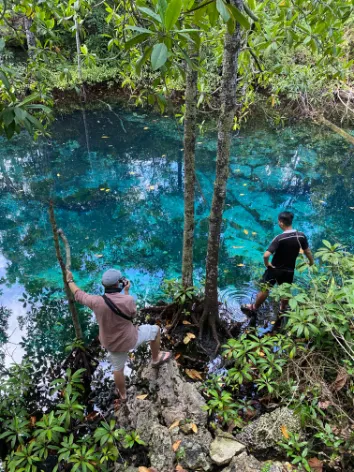
Muna's inland waters are an important entry point for understanding the island beyond its coast. Research on tourism toponyms in Lohia identifies lakes and other water objects as part of the local tourism landscape, with names such as Napabale, Motonuno, and Bumburu appearing in the discussion of local attractions. These names matter because they show that inland water is not an accidental side trip added to a beach itinerary. It is part of how the area is described, remembered, and experienced by the people who live there.
A lake visit should also be understood as more than an invitation to swim. The surrounding rock, vegetation, paths, settlement patterns, and everyday uses of water influence what a visitor sees. Some places may be suited to quiet observation and photography; others may have a closer relationship with local routines or access conditions. The available data does not justify treating all Muna lakes as having identical facilities, safety conditions, or recreational uses. A careful guide leaves room for local explanation and current verification.
For travelers, this inland-water perspective can make the route more varied. A lake creates a pause between transfers and gives the group a chance to notice the island at a different scale. Instead of moving immediately from one coastal image to another, the journey can include water enclosed by land, limestone surroundings, and signs of local use. That change of rhythm is one of the reasons Muna Island travel can feel exploratory without requiring an aggressive schedule.
Napabale Lake and Its Connection to the Sea

Napabale Lake is one of the clearest examples of why Muna cannot be understood through a simple beach narrative. Tourism descriptions place the lake at the foot of hills and describe a natural connection to the sea through a tunnel. That relationship gives the location a distinctive character: the visitor is looking at an inland body of water while also seeing how the surrounding landform links it to the open coast. The interest lies in the relationship between lake, hill, rock, and sea, not only in the surface of the water.
The connection also creates a practical reason to avoid casual assumptions. Conditions in and around a natural tunnel can be affected by tide, water movement, weather, and the local access route. Travelers should not interpret the existence of a tunnel as permission to swim through it or approach it without guidance. The safe way to understand Napabale is to ask the local operator or guide about current conditions, the appropriate viewing area, and any restrictions on entering the water. A photograph can be planned; a water crossing should never be improvised.
Napabale works well in a route as an orientation stop. It introduces the island through a landscape that is calm enough for observation but geologically and geographically connected to the coast. Give the group time to see the wider setting, ask how the lake relates to the sea, and notice the way the hills frame the water. Current facilities, fees, access conditions, and the most suitable arrival window should be verified locally rather than copied from an old itinerary.
Motonuno Lake and the Local Landscape
Motonuno provides another way to read the inland-water landscape around Lohia. Information associated with Desa Wisata Meleura describes Motonuno as being not far from Meleura Beach and refers to clear water connected with local daily activities and recreation. That description is useful because it places the lake in a lived landscape. Motonuno is not just a scenic object waiting for a visitor; its meaning also comes from its proximity to a village area and the ways people relate to the water.
This relationship is important when planning Muna attractions. A visitor may want a quiet lake view, but the place may also be part of local routines that deserve attention and respect. Do not turn a description of clear water into a ranking claim such as the best lake in Muna. The available source supports Motonuno as a local landscape and tourism object, not a competition between lakes. What makes it useful in a travel guide is the connection among water, community, recreation, and the wider Lohia setting.
Because detailed operating information can change, travelers should confirm how Motonuno is currently accessed, whether a guide is recommended, which activities are appropriate, and what facilities are available. These questions are more useful than relying on a fixed promise. They also help visitors arrive with the right expectations: the experience may be strongest when the group observes the landscape and its local context rather than forcing it into a standardized activity package.
Understanding Muna's Karst Caves
After the inland waters, Muna's karst caves introduce a different physical and interpretive environment. Karst landscapes are shaped by soluble rock and can contain caves, shelters, cavities, and exposed formations. For a traveler, that may mean uneven ground, changing light, enclosed spaces, and a stronger need to move with care. For a heritage specialist, the same landscape may also hold evidence of past human activity. These two meanings can exist together, but they should not be treated as the same thing.
Research on the Liang Kabori area identifies a wider karst landscape containing numerous caves and shelters, with archaeological work documenting a variety of rock-art motifs. That research helps explain why Muna caves deserve more than a generic adventure label. At the same time, not every cave on Muna should automatically be called an archaeological site. Some may be discussed primarily as natural attractions, while others have evidence that requires heritage-sensitive interpretation. The distinction protects both factual accuracy and the material being visited.
This is why a Muna caves experience benefits from local guidance. A guide can help a group understand where it is appropriate to walk, how to use light without damaging a site or disturbing other visitors, and which surfaces must remain untouched. Travelers should prepare for a setting that may be wet, dark, narrow, or physically uneven, but should not assume that every cave has the same level of difficulty or the same cultural significance.
Liang Metanduno and the Significance of Ancient Rock Art
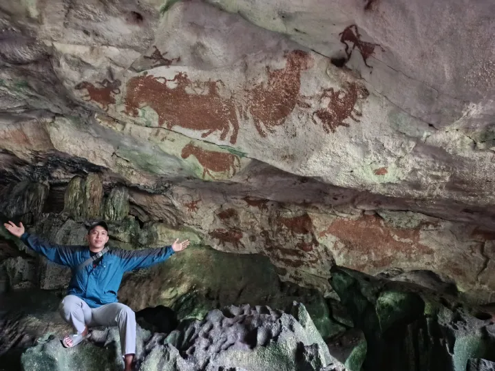
Liang Metanduno is important because the place connects a cave environment with a major question about ancient human presence in Sulawesi. It should not be introduced merely as a beautiful cave or as another stop for dramatic photographs. Research published in Nature in 2026 reported LA-U-series dating of calcite overlying a hand stencil at Liang Metanduno. The study reported an age of 71.6 plus or minus 3.8 thousand years for the dated calcite and used that result to provide a minimum-age constraint of 67.8 thousand years for the underlying motif.
The wording matters. A minimum-age constraint of 67.8 thousand years applies to the hand stencil that was studied through the dated overlying calcite. It does not mean that every painting or hand stencil on Muna is 67,800 years old. It also does not provide a direct identification of the people who made that particular stencil. The Nature research discusses the earliest Muna rock art in relation to Homo sapiens through technical, stylistic, and regional chronological considerations, while acknowledging that there is no direct method in the result to name the individual group responsible for the motif.
For a traveler, that evidence changes the quality of attention expected at Liang Metanduno. The visit is not only about entering a cave; it is about encountering a fragile record of human expression. Photography should follow local rules, and a visitor should never touch, wet, mark, scratch, or lean against a surface containing art or archaeological material. If an interpretation is offered by a guide, listen before drawing conclusions. The site deserves curiosity, but it also deserves restraint.
Liang Kabori and the Wider Cave Heritage Landscape
Liang Kabori helps place Liang Metanduno within a wider Muna heritage landscape. Academic research in the Liang Kabori area identifies rock-art panels with both figurative and nonfigurative motifs. That finding matters because it shows that the cave heritage of Muna is not represented by a single room, a single image, or one simplified story. Different panels and shelters can preserve different visual choices and different relationships between people and the karst environment.
The role of Liang Kabori in this broad guide is to give readers scale. Muna's heritage experience extends across a landscape where caves and shelters have to be understood in relation to one another, while each site still requires its own evidence and interpretation. Liang Kabori should not be used as a substitute image or a substitute name for Liang Metanduno. The two places belong to the same larger conversation about cave heritage, but they are not interchangeable destinations.
A responsible visitor does not need to memorize every motif before arriving. It is enough to understand that the surfaces may carry irreplaceable evidence, to follow access instructions, and to ask which areas are open for observation. Conservation is not an abstract concern here. It directly affects whether future visitors and researchers will be able to learn from the same panels and shelters.
Visiting Muna's Caves Is Different from Visiting a Regular Nature Attraction
A cave visit requires a different preparation level from a short viewpoint stop. Surfaces may be uneven or damp, visibility can change quickly, and a route that looks simple in a photograph may feel more demanding on foot. Wear practical footwear, keep both hands available when the terrain requires it, and follow the pace set by the local guide. Avoid assuming that a cave has lighting, rails, toilets, or other facilities simply because it appears in a tourism list. Those details need current confirmation.
The heritage dimension adds another responsibility. The central rule is simple: observe, do not touch. Do not touch rock art, calcite, walls, pigments, or surfaces that may contain archaeological material. Do not make a mark, remove a fragment, leave food, or use a flash where local guidance prohibits it. Even an apparently harmless hand placed against a wall can transfer oils, moisture, or dirt. In a fragile environment, respectful behavior is part of the travel experience rather than an optional extra.
The same principle applies to storytelling. Do not repeat a dramatic age claim without specifying what was dated, and do not call every cave an archaeological site. Ask whether a location is being visited for its geology, its documented heritage, or both. That distinction makes the experience more accurate and helps prevent the kind of casual promotion that can put vulnerable places under unnecessary pressure.
Meleura and Muna's Coastal Landscape
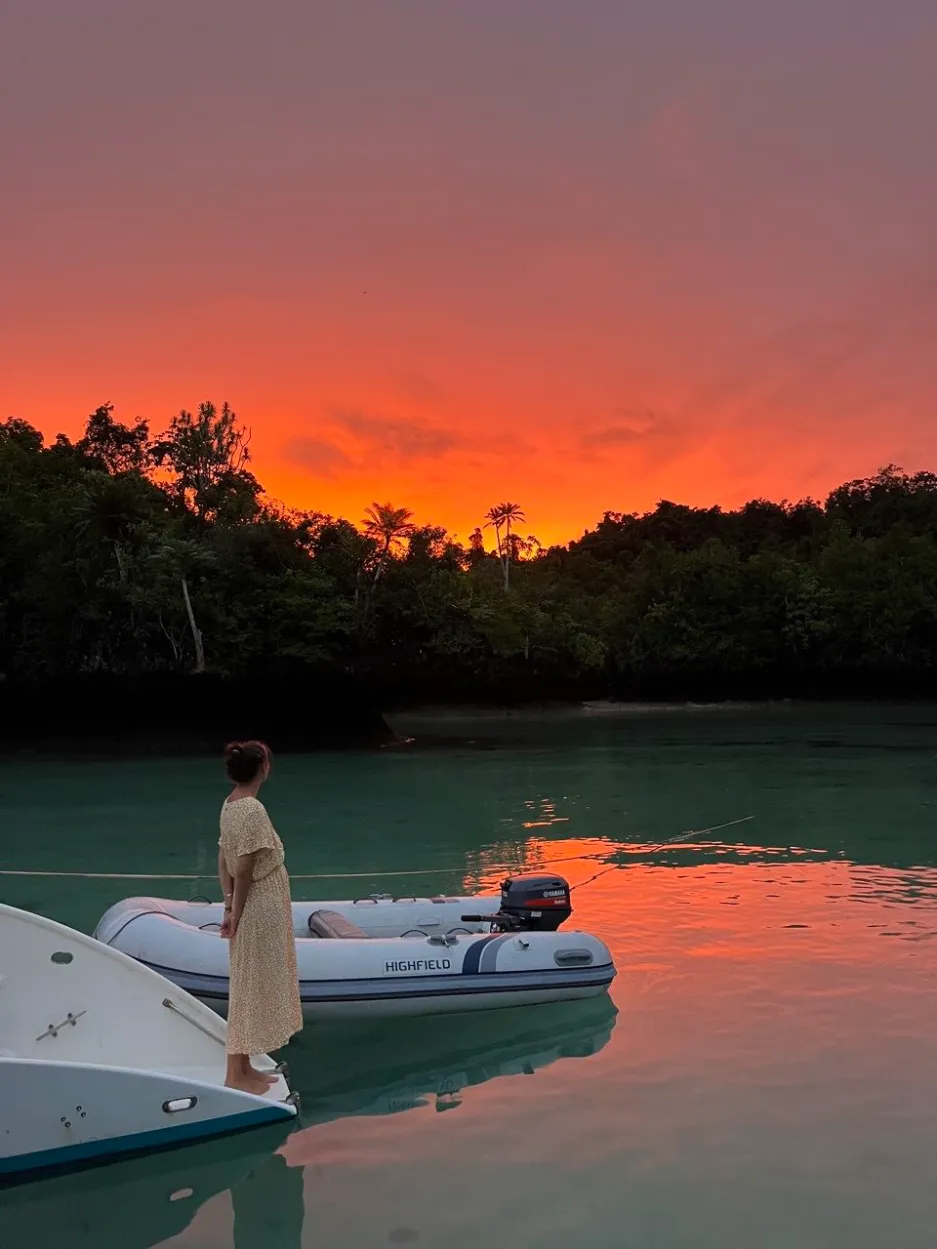
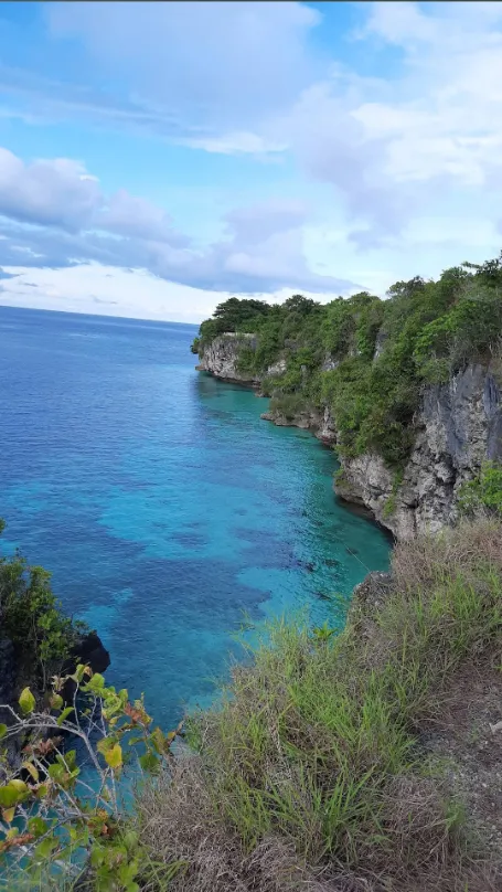
Meleura brings the journey back to the coast, but it does so with more substance than a generic beach stop. The beach is located in Lakarinta Village, Lohia District, and JADesta describes the area through clear seawater, white sand, karst rock, and tourism facilities. The combination gives the shore a recognizable physical character. Visitors are not only looking at water and sand; they are seeing how rock formations shape the edge of the sea and how the village setting supports a tourism experience.
Academic research on Meleura also supports a more specific way of describing the coast. The study of beach suitability recorded values of 87 percent, 83 percent, and 71 percent at three research stations, with two stations categorized as very suitable and one as suitable in that assessment. These numbers should remain attached to the study and its stations. They are not a guarantee that conditions, activities, or facilities will be identical on every visit. Weather, sea state, maintenance, access, and local management can change the experience.
Meleura is therefore useful as both a recovery point and an interpretation point. After a lake or cave section, the coast offers open space and a different pace. At the same time, the karst shoreline invites visitors to notice the relationship between water and stone. The best visit is not necessarily the one with the most activities. It may be the one that leaves room to understand the shore, confirm what is currently available, and enjoy the landscape without treating it as a backdrop for a rushed schedule.
The Karst Coastline Gives Meleura Its Character
The rock around Meleura is part of what makes the beach visually and geographically distinct. JADesta describes cadastral or karst rock formations around the coast, while research on the area treats the character of the substrate and shoreline as part of the destination's educational potential. This gives travelers a more useful vocabulary than simply calling the water beautiful. The coast can be read through its sand, rock, water clarity, shape, and the way those elements meet.
That interpretation should remain grounded. A photograph may show a dramatic formation, but it does not establish the age of the rock, the safety of a route, or permission to climb it. Visitors should stay within areas identified as appropriate by local managers and avoid damaging vegetation or loose surfaces. The karst setting is part of the attraction precisely because it is a real environment, not a stage that can be rearranged for a better picture.
Meleura as a Community Based Tourism Area
Meleura also matters because the tourism experience is connected to the community around Lakarinta. Ethnographic research on maritime ecotourism in Meleura describes local residents as part of tourism development and management. JADesta likewise presents Desa Wisata Meleura through facilities and community attractions, including the Ewa Wuna cultural attraction. These references support a view of the coast in which local people are participants and hosts, not scenery placed around a beach.
For visitors, that means the quality of an encounter depends partly on how they enter the social setting. Ask before photographing people, follow instructions about where to walk, and do not interrupt work or private activity for a picture. If a community activity is offered, ask what it involves, who leads it, and whether there is a contribution or booking arrangement. Operational details can change, so a current contact or local guide is the right source for what is available on the date of travel.
Community-based tourism is strongest when the visitor leaves with more than an image. A short conversation, a cultural explanation, or an understanding of how the shoreline supports local life can give the beach a deeper meaning. It also keeps the article from presenting Muna as an empty landscape waiting for outside consumption.
How to Combine Lakes, Caves and Coast into One Muna Journey
The most useful way to plan a broad Muna journey is to work with a sequence of experiences rather than a rigid list of hours. A simple concept is nature water, then cave or heritage, then coast. Inland water can provide orientation and a calm start. A karst cave or heritage site can add exploration and historical depth. The coast can provide recovery, open space, and a chance to understand community life. This sequence is a planning logic, not a fixed route that should be forced onto every group.
A nature-focused journey might connect a lake landscape with karst scenery and then a beach. A nature-and-heritage journey might place an inland-water stop before a cave, a documented art site, and a coastal pause. Travelers who prefer a slower pace may prioritize a lake, a village, and Meleura, leaving more room for conversation and observation. None of these patterns requires every named site to be visited, and none should be treated as a one-day promise without checking the route.
The final order should follow location, road conditions, weather, sea conditions, local access, physical demands, and the condition of the cave on the day. Keep room for delays and for the possibility that a guide may recommend a different sequence. Avoid publishing exact distances or travel times when they have not been verified for the specific starting point, vehicle, and conditions. The purpose of this guide is to help travelers understand the route logic before they ask an operator to build the operational plan.
What Travelers Should Confirm Before Going to Muna
The most responsible Muna Island travel plan separates stable destination character from changeable operating details. Before departure, confirm how each object is currently accessed, which transport is practical, whether a local guide is required or recommended, and what condition the road or trail is in. For a lake or coast, ask about weather and water conditions. For a cave, ask about footing, lighting, physical demands, access limits, and conservation rules. For a village visit, ask how the community arrangement is coordinated and what etiquette is expected.
Also confirm current facilities and costs rather than copying numbers from an old post. JADesta provides information about Desa Wisata Meleura, its facilities, and contact context, but prices, services, staffing, and access arrangements can change. The same caution applies to opening times, parking, boat use, food, toilets, and photography permissions. This guide intentionally does not publish a fixed price table, fixed timetable, or guaranteed duration because those details require current verification.
A short pre-trip checklist can prevent a large mismatch between expectation and reality. Ask whether the selected route includes Napabale, Motonuno, Meleura, Liang Metanduno, Liang Kabori, or another location by its exact name. Ask which images and descriptions correspond to the actual site. Then check footwear, rain protection, water, personal medication, sun protection, and spare clothing according to the route. The aim is not to over-plan every moment; it is to make sure the group is prepared for the environments it has chosen.
A Responsible Way to Explore Muna
The three main environments in this guide share one responsibility: leave the place and its people with as little unnecessary pressure as possible. At lakes, keep the shoreline clean, do not damage plants or rock, and respect activities that are part of local life. At beaches, use designated areas where available, take waste away when disposal is uncertain, and do not treat water conditions as a guarantee of safe swimming. A landscape can be attractive and still require caution.
At caves and heritage sites, the rule is stricter because the material may be irreplaceable. Do not touch rock art, make graffiti, remove fragments, or disturb archaeological surfaces. Follow a guide's instructions about light, photography, group size, and access. A responsible visitor understands that the most valuable souvenir from Liang Metanduno or Liang Kabori is knowledge, not a piece of the site.
In villages and community tourism areas, ask permission before taking photographs and accept a no without argument. Do not interrupt work, enter private spaces, or frame residents as decorative evidence of an exotic destination. Listen to local hosts and pay attention to how a cultural activity is presented. These choices connect nature, heritage, and community into one ethical way of traveling rather than treating responsible behavior as a separate checklist at the end.
Choosing Your Muna Experience
Nature lovers can shape a Muna trip around inland water, karst forms, and the coast. Napabale offers a particularly clear example of water connected to the sea, while Motonuno helps explain the relationship between a lake, local use, and the Lohia landscape. Meleura adds a coastal setting in which beach, water, rock, and community tourism belong in the same conversation. The attraction is the change in landscape, not a race to collect the greatest number of stops.
Heritage travelers may want to give more weight to Liang Metanduno, Liang Kabori, rock art, and the broader question of early human presence on Muna. That focus requires careful language and a willingness to follow conservation guidance. Liang Metanduno is significant because of the evidence studied there, including the Nature 2026 dating result for a hand stencil; Liang Kabori is part of the wider cave heritage landscape. A specialist article on ancient cave art can explore those subjects in greater depth, while this guide keeps them connected to travel planning.
Travelers who prefer slower experiences may find the strongest value in a route that allows time near a lake, a village, and Meleura rather than filling every day with transfers. The best Muna experience is not identical for every visitor. Some groups need active cave exploration, some want landscape photography, and others want to understand how coastal life and tourism meet. Muna's strength is that these choices can complement each other without pretending they are the same experience.
The central lesson is simple: Muna is a journey across connected but distinct environments. Lakes provide an inland perspective, karst caves reveal geological and heritage depth, and the coast brings beaches, sea conditions, and living communities into view. Once those relationships are understood, travelers can ask better questions, choose a more realistic pace, and build a route that reflects what they actually want to learn and experience.
Frequently Asked Questions
What is Muna Island known for?
Muna is known for a combination of karst landscapes, caves, lakes, coastal areas, and cultural heritage. Liang Metanduno is particularly significant because Nature research published in 2026 provided a minimum-age constraint of 67.8 thousand years for a hand stencil studied there.
What are the main types of attractions on Muna Island?
The experience can be grouped into inland waters such as lakes, karst caves and heritage sites, coastal landscapes such as Meleura, and community-based cultural experiences. Access and facilities should be confirmed for each location.
Why is Liang Metanduno important?
A 2026 Nature study dated calcite overlying a hand stencil at Liang Metanduno to 71.6 plus or minus 3.8 thousand years, providing a minimum-age constraint of 67.8 thousand years for the underlying motif. This does not mean every Muna painting has that age.
Is Meleura only a beach destination?
No. Meleura is part of Desa Wisata Lakarinta and its tourism landscape includes karst formations, coastal scenery, community activities, and nearby natural features.
Should visitors touch ancient cave paintings?
No. Visitors should treat rock art as cultural heritage and avoid touching, marking, wetting, or damaging cave surfaces. Follow local guidance about access and photography.
Can lakes, caves, and beaches be combined in one Muna trip?
Yes, they can form a logical travel theme, but the final route should depend on access, weather, road conditions, local coordination, physical demands, and the time available.
Plan your journey with Laode Traphel.
You May Also Like
10 Amazing Places to Explore in Wakatobi for an Unforgettable Journey
Wakatobi
Kaledupa Island Travel Guide for Exploring Nature and Local Island Life
Kaledupa, Wakatobi
.webp)
The Best Snorkeling Destinations to Explore in Wakatobi
Wakatobi
The Best Time to Visit Wakatobi for Diving Snorkeling and Island Travel
Wakatobi
The Best Time to Visit Muna Island for Nature Culture and Adventure
Muna
.webp)
How to Plan the Perfect Muna Island Trip for Nature and Culture
Muna